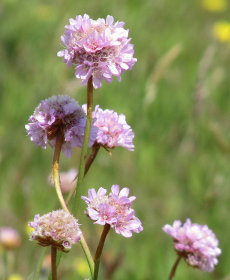
 Photo: S. Stenzel |
Within the project msave we aim to develop novel methods for the monitoring of vegetation using satellite remote sensing. The project focuses on the use of data gathered at multiple times of the year (“multi-season”) and on the joint use of different sensors (radar, optical). The methods are to take explicit account of the fact that the appearance of even one and the same type of vegetation is never identical at different sites and at different times. This variability is both a curse and a blessing for the differentiation of vegetation and must be addressed anyway. The evaluation of methods is based on examples from nature conservation and agriculture. |
Multi-seasonal remote sensing for monitoring vegetation (MSAVE)
| Ansprechpartner: | |||
|---|---|---|---|
| Förderung: | DLR, DFG | ||
| Starttermin: | 2011 | ||
| Endtermin: | 2014 | ||


