
UAVforSAT - Operationalization of Vegetation Mapping through UAV-based Reference Data Acquisitions and Cloudbased Analysis of Earth Observation Data
- Contact:
- Funding:
DLR/ BMWi
- Startdate:
08/2019
- Enddate:
07/2022
UAVforSAT - Operationalization of Vegetation Mapping through UAV-based Reference Data Acquisitions and Cloudbased Analysis of Earth Observation Data
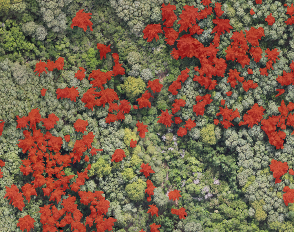
The primary aim of this project is the development of a satellite-based processing chain for operational vegetation mapping. In recent years, the availability and quality of satellite data for applied vegetation mapping increased significantly. Future mission (e.g., EnMAP) will further increase the data availability. This data basis offers a high potential for various tasks, e.g., the identification of invasive species, plant functions or biodiversity monitoring. However, an operationalization of such tasks is inherently limited by two main factors: Firstly, the training and validation phase both require ample reference data. The acquisition of reference data is usually performed in-situ and comes with high costs and logistic efforts. Secondly, increasing availability of earth observation data is followed by increased requirements for computation and data storage requirements. The full potential of earth observation data is thus often limited using local machines. Given these limitations, this project aims to combine two key technologies, Unmanned Aerial Vehicles and Deep Learning Algorithms (CNN) for an automatized reference acquisition. The respective vegetation maps will be the basis for a subsequent large scale vegetation mapping using satellite data within a cloud-computing framework (DIAS). Altogether, it is aimed to develop a modular and operational processing chain that is transferable among UAVs, satellite sensors and applications.