
Writing thesis in the Working group Floodplain ecology
Following thematic areas for Bachelor/Master Thesis are offered at the Institute for Floodplain Ecology in Rastatt
- Riparian zones-Ecology
- Vegetation science
- Hydromorpholgy and
- GIS

|
|
TopicsThe topics are sorted according to the offering working groups. Unless otherwise specified, the topics are suitable for both theses in the bachelor's degree and for those in the master's degree. You can also look for a geo-ecological topic externally (examples can be found in the "More" tab). The FAQ page provides information about possible combinations of examiners.
The lists are not complete and it is worth to ask in the working groups what is currently going on. Lecturers are open to further thematic proposals. If you're interested, please direct your requests directly to the supervisors of each group. ProceduresThe regulations can be found on the FAQ page or in the respective examination regulations (Downloads).
|
The Geomorphology and Soil science group offers exciting topics in the field of biogeochemical processes in temperate and tropical ecosystems.
|
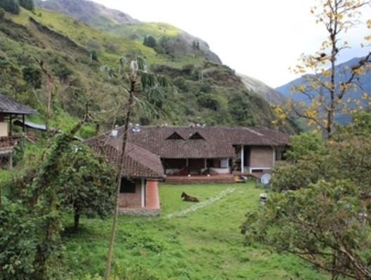
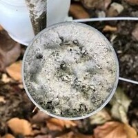
San Francisco Research Station in the tropical montane forest in Ecuador. Photo: A. Velescu |
TopicsWe investigate particularly the influence of biodiversity, climate and atmospheric deposition on nutrient cycling (i.e. C, N, Ca, K, Mg) and on pollutants in soil and ecosystems.
ContactFor Bachelor and Master theses in Soil science please contact Wolfgang Wilcke.
Available topicsFor currently available topics for Bachelor and Master thesis in the Geomorphology and Soil science group please refer to the German version of our website. |
The Vegetation Science Working Group offers topics in the following areas. Partially there are overlaps, i.e. topics may touch several of the blocks.
_klein_200x200.JPG) |
Process-based modeling of plant communitiesThis involves modeling the influence of the environment and environmental changes on the species composition of vegetation, based on process understanding (as opposed to statistical approaches). Model systems are often macrophyte communities. Contact: Anne Lewerentz (anne.lewerentz∂kit.edu) |
 |
Remote sensing of vegetation: 3D vegetation architecture.Here, the focus is on remote sensing of the "architecture" of plant cover and the implications for the environment, e.g., for the habitat quality of animal species or for soil erosion due to splash effects (see topic block below). Often based on imagery obtained with drones and photogrammetric techniques applied to it. Contact: Johannes Senn(johannes.senn∂kit.edu)
|
 |
Remote sensing of vegetation: species, habitats.This is about remote sensing of the condition of habitats and the occurrence of species Contact: Michael Ewald (michael.ewald∂kit.edu), Sebastian Schmidtlein (schmidtlein∂kit.edu)
|
 |
Remote sensing of vegetation: strategies and traits.This is about remote sensing of patterns in the occurrence of strategy types and plant traits (such as leaf traits) along site gradients. Contact: Michael Ewald (michael.ewald∂kit.edu), Sebastian Schmidtlein (schmidtlein∂kit.edu)
|
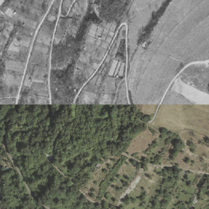 |
Monitoring of changes in plant communitiesThis involves the analysis of changes in plant communities, e.g. by resurveying previously studied areas, by examining historical herbarium material or data sets covering larger time spans. Remote sensing is also used here in some cases. Contact: Michael Ewald (michael.ewald∂kit.edu), Sebastian Schmidtlein (schmidtlein∂kit.edu), Christophe Neff (christophe.neff∂kit.edu)
|
 |
Vegetation and erosionThe aim here is to investigate the influence of vegetation cover on soil erosion processes. The main focus is on the interaction of precipitation, plant architecture and splash effects. In some cases, remote sensing techniques are used for this purpose (see separate topic block above). Contact: Johannes Senn (johannes.senn∂kit.edu)
|
 |
Macroecology and biogeographyThe goal here is to examine patterns in the spatial occurrence of plant species and plant traits, thereby tracking ecological processes that are not otherwise readily apparent. Contact: Sebastian Schmidtlein (schmidtlein∂kit.edu), Michael Ewald (michael.ewald∂kit.edu), Anne Lewerentz (anne.lewerentz∂kit.edu)
|
EcoinformaticsThe aim here is to develop or improve algorithms for the analysis of vegetation ecology data, to develop software and to improve exchange formats for vegetation data. Contact: Sebastian Schmidtlein (schmidtlein∂kit.edu)
|
Master
Global effects of individual behaviour in the land sector
Human land use has had substantial impacts around the world, profoundly altering natural systems and processes. Feedbacks in the forms of climatic change and ecosystem collapse are likely to pose serious challenges for humanity in the future, and the land sector will need to adapt if it is to continue supplying essential goods and services. While these changes and their consequences are global in nature, underlying decisions about land management are made by individuals, communities and societies at far smaller scales. This project will involve a meta-analysis of existing evidence about the effects of these small-scale decisions, to uncover the behavioural factors that are important in shaping global-scale land use change. This will feed into improved modelling of the land system under future climate change and policy interventions. For further information contact Calum Brown (calum brown ∂does-not-exist.kit edu) or Mark Rounsevell (mark.rounsevell@kit.edu).
Feedbacks between land use and ecosystem service provision
Human land use provides a wide range of ecosystem services, but with many negative consequences and trade-offs. Given the need to feed a growing human population, it is essential to understand how well particular land uses provide particular services, and to what extent they prevent the provision of others. This project will examine the evidence for links and feedbacks between land uses and ecosystem services to allow better modelling and planning of land use change. Existing assessments will be reviewed alongside primary evidence of land use impacts on natural systems, and these will be used to improve model-based representations of land system development. For further information contact Calum Brown (calum brown ∂does-not-exist.kit edu).
Improving the representation of European land use change in agent-based models
Human land use has had substantial impacts around the world, profoundly altering natural systems and processes. Feedbacks in the forms of climatic change and ecosystem collapse are likely to pose serious challenges for humanity in the future, and the land sector will need to adapt if it is to continue supplying essential goods and services. Agent-based models allow us to explore how people’s responses to environmental change shape future land use, and are now being applied at European scale. This project will develop an existing agent-based model of European land use change (CRAFTY-EU) to improve its representation of land use processes and consequences. Primary data on land use types and impacts will be combined with reviewed information of land management decision-making to allow modelling with finer resolution than is currently possible, giving new insight into the future of the European land system. There is also an option of developing a version of CRAFTY for Germany. For further information contact Calum Brown (calum brown ∂does-not-exist.kit edu) or Mark Rounsevell (mark.rounsevell@kit.edu).
Modelling climate adaptation in patterns of production and consumption
Adaptation to climate change is necessary for the continued production of the goods and services that people require. However, such adaptation can be difficult and disruptive, and tends to occur slowly if at all. One reason for this is that adaptation decisions depend upon individual characteristics and social influences that take time to develop. Building on insights from adaptation psychology and a simple agent-based model of adaptive decision-making in production and consumption sectors (coded in NetLogo), this project will explore the ways in which generic adaptation can develop, spread, and ensure sustainable provision of goods and services under climate change. For further information contact Calum Brown (calum brown ∂does-not-exist.kit edu).
Evaluating the performance of past land use change scenarios
The scenario method is used extensively in environmental change assessments, including in the development of alternative projections of land use change. One of the earlier such studies (Ewert et al., 2005; Rounsevell et al., 2005; Rounsevell et al, 2006) used the year 2000 as a baseline and projected European land use change (EU15 at the time) for time slices to the end of the 21st Century. This means that we now have nearly 20 years of observed land use change time series against which to evaluate the performance of these early scenarios. An evaluation is useful in that it provides insights into how land use change models performed, but also to better understand how the drivers of land use change played out in practice. This study will evaluate the performance of these earlier land use change scenarios against the actual land use change since the year 2000, as well as exploring whether the assumptions about the trends in critical land use change drivers (economy, population, social preferences, technology, …) were correct. Contact: Prof. Mark Rounsevell (mark rounsevell ∂does-not-exist.kit edu)
References
Ewert, F., Rounsevell, M.D.A., Reginster, I., Metzger, M. and Leemans, R. (2005). Future scenarios of European agricultural land use. I: Estimating changes in crop productivity. Agriculture, Ecosystems and Environment, 107, 101-116
Rounsevell, M.D.A. Ewert, F. Reginster, I., Leemans, R. and Carter, T.R. (2005). Future scenarios of European agricultural land use. II: projecting changes in cropland and grassland. Agriculture, Ecosystems and Environment, 107, 117-135
Rounsevell, M.D.A, Reginster, I., Araújo, M.B., Carter, T.R., Dendoncker, N., Ewert, F., House, J.I., Kankaanpää, S., Leemans, R., Metzger, M.J., Schmit, C., Smith, P. and Tuck, G. (2006). A coherent set of future land use change scenarios for Europe. Agriculture, Ecosystems and Environment, 114, 57-
Bachelor
Explore climate change or land-use change impacts on ecosystem functioning (such as carbon, nitrogen, water cycles, biome distribution, crop yields...) globally or regionally. Work includes analysis of model simulations using the dynamic global vegetation model LPJ-GUESS for different future scenarios. Work could also include to perform simple simulations by the student for individual locations. The exact question and related analysis will be discussed with the student.
Master
Wildfire damages: The risk for wildfires is expected to increase under climate change and to spread into new areas. As a consequences, damages from wildfire might also increase, as well as costs for fire management. The thesis would be based on 1) a systematic literature review of (recent) past economic and non-economic damages of large wildfires and 2) use the results from the literature review for e.g., a meta-analysis and/or to extract relationships between damages and other societal measures (e.g. combining statistical data and GIS-based analyses).
For someone with knowledge in machine-learning tools — Building a forest emulator model: Forestry is an important factor in climate change: for carbon storage, for providing building materials or for using wood as bioenergy source. But forestry is at the moment not yet well represented in models of land-use change, even though forest-owner decision making on which of these forest uses they prefer will impact forest management greatly. We seek to represent forestry better in the LandSyMM model (Alexander et al., GCB, 2018,10.1111/gcb.14110), which combines natural constraints on vegetation growth with socio-economic supply and demand. To do so we aim to build a forest-growth emulator which allows to rapidly project forest growth per modelled-gridcell in response to climate change and atmospheric CO2; this emulator can then be efficiently coupled within LandSyMM.
---
Note: Students should be present at IMK-IFU during most of the thesis work to facilitate regular exchange. We can pay a small HiWi contract that helps to cover local accommodation costs. Theses can be written in German or English.
In addition, externally conducted theses can also be carried out (please check the details in the regulations). The following overview is intended to make it easier to find lecturers at the Institute for Geography and Geoecology who are available as examiners for such external work. The compilation is not complete.
Botany: Arneth, Damm, Egger, Ewald, Householder, Lewerentz, Neff, Schmidtlein, Wittmann
Remote sensing: Ewald, Senn, Schmidtlein
Meteorology: Hogewind, Schmidtlein
Zoology: Schmidtlein, Wittmann