
Development of a UAV-based remote sensing procedure for ecosystem monitoring
- Contact:
- Funding:
GRACE (KIT)
- Startdate:
2014
- Enddate:
2016
UAV-based remote sensing
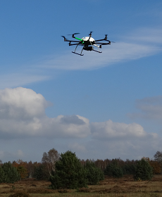 Foto: J. Lopatin |
The project follows a trans-disciplinary approach combining remote sensing techniques with ecological methods and theory. The scientific objectives embrace the application of an unmanned aerial vehicle (UAV) for environmental monitoring as well as the use of these data in ecological model building. It is intended to make use of a sensor with very high spectral resolution. So called hyperspectral information shall be gathered from the UAV device. The project targets the mapping of several aspects of ecosystem dynamics such as successional dynamics of non-forested landscapes, the spread of invasive species as well as eutrophication and subsequent shifts in plant functional types. To capture these processes a number of vegetation traits will be measured in the field or modelled and projected into the area via remote sensing. |