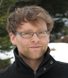
Benjamin Mack
Topics
- Land use / land cover mapping
- One-class and partially supervised classification
- Synergistic usage of optical and SAR data
- Estimation of soil sealing
Curriculum vitae
| Since 2013 | Research assistant at the Institute of Geography and Geoecology at the Karlsruhe Institute of Technology (KIT) |
| Since 2010 | PhD student. Topic: Optimization of one-class classification approaches. |
| 2010-2011 | Research Assistant at the Juniorprofessorship for Remote Sensing in agriculture, Institute of Geodesy and Geoinformation, University of Bonn. Project: Remote sensing based retrieval of biomethane potential (BMP) of crops, with regard to the EnMAP mission. |
| 2009-2010 | Research Assistant at the Center for remote sensing of land surfaces, University of Bonn. Project: Enviland 2 – Synergistic usage of optical and SAR data (Focus on soil sealing). |
| 2009 | Magister Artium in Geography (Bonn). Magister-Thesis: ‘Factors influencing reflectance measurements in field spectroscopy – a comparative study on the reproducibility of measurements from two spectroradiometer systems.’ Supervisors: Prof. Gunter Menz, Prof. Sebastian Schmidtlein |
| 2002 | Abitur in Bad Saulgau |
Teaching
WS 2013/14
- Umweltmonitoring mit Fernerkundung
- Übung: Allgemeine Klimageographie/Klimatologie
Talks and Posters
Mack B. & B. Waske. Making One-Class Classification Feasible for Large Area Applications - An Iterative Approach. ESA Living Planet Symposium 2013, Edinburgh, United Kingdom.
Mack B. & B. Waske. Partially Supervised Land Cover Classification with MaxEnt. 7th Workshop of the EARSeL Special Interest Group Imaging Spectroscopy, 11.4.-13.4.2011, Edinburgh, United Kingdom.
Mack B. & B. Waske. Partially Supervised Classification of Agricultural Crops with TerraSAR-X and Radarsat-2 Data. IEEE International Geoscience and Remote Sensing Symposium, München.
Mack B. & B. Waske. Vergleich von Regressionsverfahren zur Ableitung des Blattflächenindex aus Hyperspektraldaten. Gastvortrag im Rahmen des Forum GI am Institut für Geoinformatik und Fernerkundung, 25.06.2012, Osnabrück.

