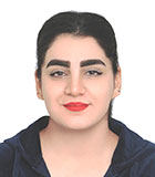
Elham Shafeian
- Gruppe: Vegetation
- elham shafeian ∂does-not-exist.partner kit edu
Karlsruher Institut für Technologie (KIT)
Institut für Geographie und Geoökologie
Kaiserstr. 12
76131 Karlsruhe
Germany
Elham Shafeian
Topics
- Forest decline
- Plant species interactions
- Change detection using remote sensing
Curriculum vitae
|
2018 |
IUFRO Grant (The Special Program for Development of Capacities (SPDC)) for Oral presentation in the 6th International Conference on Plants and Environmental Pollution (ICPEP-6), hold in Lucknow, India |
|
Since 2018 |
PhD student at the Institute of Geography and Geoecology (KIT). Topic: Multi-scale remote sensing and dendro-chronological methods for an improved understanding of forest decline in the Zagros forest area, Iran (Prof. D. Schmidtlein, Dr. F. Fassnacht) |
|
Since 2018 |
DAAD Research Grant for PhD in Germany |
|
Since 2018 |
Gundishapur Grant (A Joint project between the University of Tehran and The University of Nantes) |
|
2016 |
Aspirant Grant funded by Karlsruhe Institute of Technology, Germany, 10th March-10th April, 2017 |
|
2012-2014 |
Master of Science at the University of Tehran in Range Management and Ecology, thesis: “Preparing vegetation products map and classification of condition of Taliqan rangelands using Remote Sensing methods”, Iran (Dr. Hossein Arzani and Dr. Seyed Kazem Alavipanah)
|
|
2008-2012 |
Bachelor of Science at the University of Guilan in Range and Watershed Engineering, Iran, thesis: Social and economic issues in Masuleh district |
|
2005-2008 |
High School Diploma: Esmat High School – Karaj, Iran
|
Publications
Mosig, C.; Vajna-Jehle, J.; Mahecha, M. D.; Cheng, Y.; Hartmann, H.; Montero, D.; Junttila, S.; Horion, S.; Schwenke, M. B.; Koontz, M. J.; Maulud, K. N. A.; Adu-Bredu, S.; Al-Halbouni, D.; Ali, M.; Allen, M.; Altman, J.; Amorós, L.; Angiolini, C.; Astrup, R.; Awada, H.; Barrasso, C.; Bartholomeus, H.; Beck, P. S. A.; Bozzini, A.; Braun-Wimmer, J.; Brede, B.; Breunig, F. M.; Brugnaro, S.; Buras, A.; Burchard-Levine, V.; Camarero, J. J.; Candotti, A.; Capuder, L.; Carrieri, E.; Centritto, M.; Chirici, G.; Cloutier, M.; Conciani, D. E.; Conciani, D.; Cushman, K. C. C.; Dalling, J. W.; Dao, P. D.; Dempewolf, J.; Denter, M.; Dogotari, M.; Díaz-Delgado, R.; Ecke, S.; Eichel, J.; Eltner, A.; Fabbri, A.; Fabi, M.; Faßnacht, F. E.; Ferreira, M. P.; Fischer, F. J.; Frey, J.; Frick, A.; Fuentes, J.; Ganz, S.; Garbarino, M.; García, M.; Gassilloud, M.; Gazol, A.; Gea-Izquierdo, G.; Gerberding, K.; Ghasemi, M.; Giannetti, F.; Gillan, J.; Gonzalez, R.; Gosper, C.; Greene, T.; Greinwald, K.; Grieve, S.; Große-Stoltenberg, A.; Gutierrez, J. A.; Göritz, A.; Hajek, P.; Hedding, D.; Hempel, J.; Heremans, S.; Hernández, M.; Heurich, M.; Honkavaara, E.; Höfle, B.; Jackisch, R.; Jucker, T.; Kalwij, J. M.; Kepfer-Rojas, S.; Khatri-Chhetri, P.; Kleinebecker, T.; Klemmt, H.-J.; Klouček, T.; Koivumäki, N.; Kolagani, N.; Komárek, J.; Korznikov, K.; Kraszewski, B.; Kruse, S.; Krüger, R.; Kuechly, H.; Kwong, I. H. Y.; Laliberté, E.; Langan, L.; Latifi, H.; Leal-Medina, C.; Lehmann, J. R. K.; Li, L.; Lines, E. R.; Lisiewicz, M.; Lopatin, J.; Lucieer, A.; Ludwig, A. D.; Ludwig, M.; Lyytikäinen-Saarenmaa, P.; Ma, Q.; Mansuy, N.; Peña, J. M.; Marino, G.; Maroschek, M.; Martín, M. P.; Martín-Benito, D.; Matham, P. K.; Mazzoni, S.; Meloni, F.; Menzel, A.; Meyer, H.; Miraki, M.; Moreno, G. M.; Moreno-Fernández, D.; Muller-Landau, H. C.; Mälicke, M.; Möhring, J.; Müllerova, J.; Naidu, S. S.; Nardi, D.; Neumeier, P.; Nita, M. D.; Näsi, R.; Oppgenoorth, L.; Orunbaev, S. Z.; Palmer, M. E.; Paul, T.; Pfenning, M.; Potts, A. J.; Prasanna, G. L.; Prober, S. M.; Puliti, S.; Pérez-Luque, A. J.; Pérez-Priego, Ó.; Pérez-Priego, O.; Reudenbach, C.; Revuelto, J.; Rivas-Torres, G.; Roberge, P.; Roggero, P. P.; Rossi, C.; Ruehr, N. K.; Ruiz-Benito, P.; Runge, C. M.; Satta, G. G. A.; Scanu, B.; Scherer-Lorenzen, M.; Schiefer, F.; Schiller, C.; Schiller, C.; Schladebach, J.; Schmehl, M.-T.; Schmid, J.; Schmidt, T. A.; Schwarz, S.; Seidl, R.; Seifert, T.; Barba, A. S.; Shafeian, E.; Shapiro, A. C.; de Simone, L.; Sohrabi, H.; Soltani, S.; Sotomayor, L. N.; Sparrow, B. D.; Sparrow, B.; Steer, B. S. C.; Stenson, M.; Stöckigt, B.; Su, Y.; Suomalainen, J. M.; Tamudo, E.; Barbieri, M. J. T.; Tomelleri, E.; Torresani, M.; Trepekli, K.; Ullah, S.; Ullah, S.; Umlauft, J.; Vargas-Ramírez, N.; Vatandaslar, C.; Visacki, V.; Volpi, M.; Vásquez, V.; Wallis, C. I. B.; Weinstein, B. G.; Weiser, H.; Wich, S.; Ximena, T. C.; Zarco-Tejada, P. J.; Zdunic, K.; Zielewska-Büttner, K.; de Oliveira, R. A.; van Wagtendonk, L.; von Dosky, V.; Kattenborn, T.
2026. Remote Sensing of Environment, 332, 115027. doi:10.1016/j.rse.2025.115027
Shafeian, E.; Ewald, M.; Latifi, H.; Fassnacht, F. E.
2024. (R. Manso, Hrsg.) Forestry: An International Journal of Forest Research. doi:10.1093/forestry/cpae048
Fassnacht, F. E.; Mager, C.; Waser, L. T.; Kanjir, U.; Schäfer, J.; Buhvald, A. P.; Shafeian, E.; Schiefer, F.; Stančič, L.; Immitzer, M.; Dalponte, M.; Stereńczak, K.; Skudnik, M.
2025. Forestry: An International Journal of Forest Research, 98 (2), 233–252. doi:10.1093/forestry/cpae021
Ghasemi, M.; Latifi, H.; Shafeian, E.; Naghavi, H.; Pourhashemi, M.
2024. International Journal of Remote Sensing, 45 (4), 1079 – 1109. doi:10.1080/01431161.2024.2305630
Shafeian, E.
2024, Januar 15. Karlsruher Institut für Technologie (KIT). doi:10.5445/IR/1000167177
Shafeian, E.; Fassnacht, F. E.; Latifi, H.
2023. European Journal of Remote Sensing, 56 (1), Art.-Nr. 2260549. doi:10.1080/22797254.2023.2260549
Shafeian, E.; Fassnacht, F. E.; Latifi, H.
2021. International Journal of Applied Earth Observation and Geoinformation, 105, Art.-Nr.: 102621. doi:10.1016/j.jag.2021.102621
