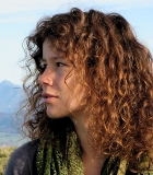
Dipl.-Biol. Stefanie Stenzel
- Gruppe: Vegetation
- Sprechstunden: nach Vereinbarung
- Raum: Geb. 10.50, Raum 818
- stefanie stenzel ∂does-not-exist.partner kit edu
Karlsruher Institut für Technologie (KIT)
Institut für Geographie und Geoökologie
Kaiserstr. 12
76131 Karlsruhe
Germany
Stefanie Stenzel
Topics
- Optical, multiseasonal, multispectral remote sensing
- Natura 2000
- High Nature Value-Farmland (HNV)
- One Class Classification
- Lichenology
- Microbiology
Curriculum vitae
| Since 2011 | PhD student in the projekt msave. Working title: "Multiseasonal remote sensing for monitoring vegetation". (Supervisor: Prof Schmidtlein) |
| 2010 |
Diploma Thesis (in Cooperation with Federal Agency for Nature Conservation, BfN) Stenzel. S. (2010): The High Nature Value (HNV)-Farmland-Indicator in Germany. Potentials and the accuracy of field mapping method using grassland as an example. Rheinische Friedrich-Wilhelms-Universität Bonn, Nees Institut for Biodiversity of Plants & Institute of Crop Science and Resource Conservation INRES. |
| 2004-2010 | Study of Biology (Diploma) at Rheinische Friedrich-Wilhelms-Universität, Bonn. |
Teaching
- Große Exkursion Bayerisches Oberland und Nördliche Kalkalpen 2013 - Assistenz
- Landschaftsökologisches Praktikum LÖP 2013 - Responsible for subtopic vegetation
Presentations
Conference proceedings
Feilhauer H, Stenzel S, Kübert C, Metz AK, Conrad C, Ehlers M, Esch T, Klein D, Oldenburg C, Reinartz P, Schmidtlein S (2012). RapidEye im Projekt MSAVE - Multisaisonale Fernerkundung für das Vegetationsmonitoring. In: Borg E, Daedelow H, Johnson R (Hrsg.): RapidEye Science Archive (RESA) 'Vom Algorithmus zum Produkt'. 4. RESA Workshop, Neustrelitz, pp 153-164.
Talks
Stenzel S, Feilhauer H, Schmidtlein S. „Alles im grünen Bereich?“ - Multisaisonale Fernerkundung naturschutzrelevanter Vegetationstypen. Geographentag 2013, Passau.
Stenzel S, Feilhauer H, Metz A, Schmidtlein S. Monitoring habitat types with multiseasonal remote sensing and MaxEnt. GFÖ 2013, Potsdam.
Stenzel, S, Feilhauer, H, Kübert, C, Metz, A, Schmidtlein, S. RapidEye im Projekt msave - Multisaisonale Fernerkundung für das Vegetationsmonitoring. 4. RESA-Workshop 2012, Neustrelitz.
Stenzel, S, Benzler, A, Weddeling, K, Sukopp, U. Noch grün hinter den Ohren? - Das Potential des High Nature Value (HNV)-Farmland-Indikators am Beispiel des Grünlandes. AK Biogeographie 2011, Hamburg.
Stenzel S, Feilhauer H, Metz A, Oldenburg C, Schmidtlein S. Monitoring habitat types with multiseasonal remote sensing and MaxEnt. IAVS 2013, Tartu, Estland.
Stenzel, S, Feilhauer, H, Schmidtlein, S. msave – Multiseasonal Remote Sensing for Monitoring Vegetation. AK Macroecology 2012, Frankfurt.
